Using Social Media to Quantify Forest-Based Tourism in the Northern Forest

Forest-based recreation and tourism contribute an estimated $14 billion to the economy in the northeastern United States. Park managers and tourism promotion agencies depend on visitor use information to guide recreation and tourism planning. Parks throughout the Northern Forest Region rely on collection of visitor information from park admissions and visitor surveys, techniques that can be time consuming and costly.
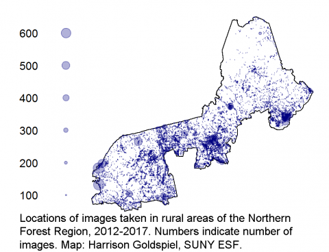
Using data from images posted online through Flickr, NSRC researchers explored the use of social media to quantify forest-based tourism in the region. Researchers identified visitor hotspots from the number of images found per square kilometer and generated maps showing areas having the highest density of images. They mapped connections between destinations in the region and movement of visitors by identifying locations of consecutive photos taken. Most visitors took photos of natural and scenic aspects of their experiences such as trees (45%), sky (40%), water (27%), and wilderness (20%). Images also often focused on recreational aspects of visitors’ experiences (e.g., hiking, skiing), seasons, and wildlife observations.
Findings indicate that social media data can be used to: identify hotspots of visitor use, trace itineraries of visitor travel, and better understand perceptions of visitors toward parks and outdoor recreation experiences. Although researchers identified significant relationships between social media data and park admissions data, it is likely not feasible for most park agencies to use social media to estimate park attendance at this time due to extensive costs and time involved in analysis. Strategies for simplifying access to and use of social media data for park management purposes are needed in the future.
