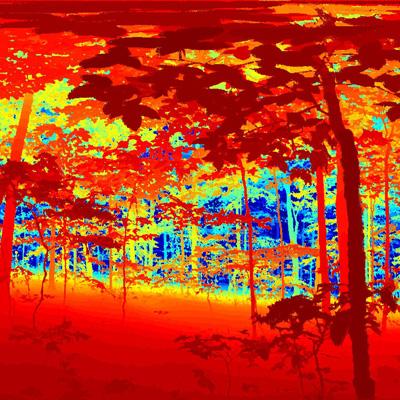
Evaluation of Northern Hardwood Forest Structure Using Terrestrial Laser Scanning (Ground-Based LIDAR)

Terrestrial laser scanning (TLS), also known as ground-based LIDAR, is a new technology that holds substantial promise for quantifying important forest ecosystem characteristics, such as position, size, and architecture of tree stems; position, size, and shape of tree crowns; and density of foliage within the crown. These attributes influence both the economic value of forests and the processes driving ecosystem development.
NSRC researchers conducted terrestrial laser scans at New Hampshire's Bartlett Experimental Forest where they set up a laser scanner on a tripod over a fixed point in the forest. The scanner rotated rapidly, sending out millions of laser pulses, and each pulse that contacted a solid object resulted in a 3-dimensional coordinate for that point. A collection of points is called a "point cloud." Researchers did the scanning in the summer to collect leaf-on data to measure tree crown properties and in April for leaf-off data to better measure tree stems.
Because of the high costs of obtaining and using TLS instruments and some difficulty separating trees from other understory objects, researchers believe TLS is not yet ready for operational forest inventory. However, they came up with new approaches that will make it extremely useful for ecosystem research. They developed a new mathematical algorithm for extracting individual trees from point cloud data which would aid in measurement of tree branching and taper. TLS also compared well to conventional field methods of tree crown structure measurement and, in combination with the individual tree extraction technique, will be useful for describing individual tree crowns.
Download printable version [PDF]
Download full final report [PDF]
