Functional Classification of Land Use across the Urban-Rural Gradient to Support Watershed Planning in the Northern Forest
Parts of the Northern Forest region are experiencing rapid urbanization, and this land use change can have significant impacts on water quality by altering biogeochemical cycles. However, relationships between land use and biogeochemical processes are still poorly understood. Addressing this problem requires very high resolution characterization of land use, but existing methods of mapping land cover lack sufficient resolution, or accuracy and detail, to properly characterize variation found in mixed forested and urbanized environments.
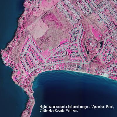
This project builds upon previous research conducted at the University of Vermont in which soils in 61 residential yards in Chittenden County, Vermont were sampled for soil characteristics, nutrient levels, and processing rates. NSRC researchers mapped land cover information using cutting-edge techniques that replicate humans’ natural visual classification of objects and that could be statistically related to nutrient measures. Researchers focused on soil phosphorus, an important pollutant in the Lake Champlain Basin. They produced a highly detailed land cover map for much of the County and found that land cover at this scale accurately predicts available phosphorus levels from the soil samples.
Results suggest that available phosphorus can vary greatly within urban landscapes depending on micro-scale land cover. Specifically, phosphorus is lower where there are high levels of tree or grass cover, which may act as nutrient sinks. High-resolution classified land cover data is thus an important tool in mapping potential sources and sinks of nutrients. As high-resolution imagery becomes more available, techniques from this project can be applied to create detailed characterizations and inventories of land cover for urbanizing landscapes throughout forested regions.
Download printable version [PDF]
Download full final report [PDF]