Photopoint Monitoring in the Adirondack Alpine Zone

Alpine ecosystems, located on the highest mountain summits, are unique features of the Northern Forest region. They are home to the region’s rarest plant species and provide some of the region’s greatest recreational opportunities. The Adirondack alpine zone in northern New York comprises approximately 173 acres with a large number of rare, threatened, and endangered plant species, adapted for harsh summit conditions but fragile to human foot traffic.
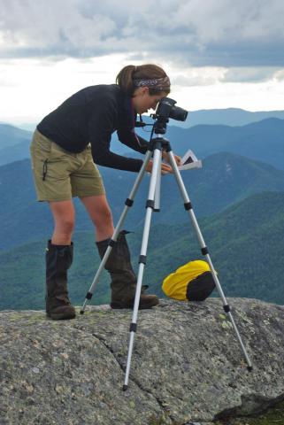
The Adirondack High Peaks Summit Steward Program was created in1989 to protect the Adirondack alpine ecosystem through backcountry education, conservation, and research. As educators, the stewards provide on-site interpretation of the fragile alpine ecosystem. As researchers, they have tracked vegetative change, since 1999, using photopoint monitoring. Photopoints are photographs of a landscape area taken repeatedly from the same exact position, showing qualitative changes over time and illustrating rates of trampling, erosion, and vegetative re-growth. Photographs from the mid-1960s through the mid-1980s serve as the baseline.
In 2009, NSRC researchers in the steward program re-shot 40 of the 50 photopoints. Using an image manipulation program, they analyzed photos for changes in percent photocover of bare rock, exposed soil, and vegetation and compared photopoint series between mountains with regular steward presence versus mountains without. Researchers found a significant difference in changes in vegetation and bare rock on stewarded versus non-stewarded summits. The increase in vegetation and decrease in rock over time suggest that alpine areas subject to human trampling are recovering. The faster recovery rate on stewarded summits suggests steward presence may serve as a significant deterrent to further trampling.
Download printable version [PDF]
Download full final report [PDF]
